I'm finding Charles Fiott's book on the villages of the South very helpful in building my general map of the area. He suggests that we can group the diverse southern villages into the "bay villages" including Marsaxlokk, Birzebbugia and Zejtun; the "central wadis" including Qormi, Zebbug and Siggiewi; and the "airport villages" including Ghaxaq, Gudja, Kirkop, Safi, Zurrieq, Qrendi, Mqabba and Luqa. It was the "airport villages" that was the focus of Malta Ramblers' walk on Saturday.
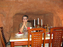
The photo was taken just off the main square in Qrendi where we planned to meet at 9.45. The full walk was planned as a 7 hour circuit leaving from Luqa but I could not work out how to get to Luqa for 8.00am without adding a further two hour walk from M'xlokk so I decided to get buses to Qrendi and join part way along the route. Other people had also decided to take this option. Qrendi is already familiar to me, but this time we were not intending to walk out to Hagar Qim although we did start off heading towards Mqabba which was the direction we started out for our previous circular walk from Qrendi.
The focus of this walk was to visit four of the seven Santa Marja churches on the old processional route from Mosta. The difficulty was that we set off at a cracking pace in order to cover the distance and everyone else on the walk was Maltese so the leader used Malti to explain what was happening. As a result, everything is somewhat blurred and I'm not sure what churches we visited.
I do know that we visited a lovely medieval chapel at Mqabba that was dedicated to St Basil and had all the features of the medieval chapels that I've visited elsewhere - square construction, vaulted arches, single bell tower over the door. It has probably had several additions since it was first built and it appears to have been renovated recently. There is an interesting skull and cross bones in the courtyard with the date 1776 and a date on the side of the church is 1669.
We visited here just after leaving the main square of Mqabba which I think is where one of the Santa Marjas is and where we stopped briefly for refreshment. I called in to one of the band clubs around the square and ordered a black coffee because I was feeling a bit off from the Maltese winter cold that I have finally picked up. When it came, I just had time for a couple of sips before I noticed we were all on the move again, so I had to leave my mug steaming on the table.
Somewhere on the route, I found we were walking past a familiar chapel and the country road was familiar. I realised it was the place I got lost when I was on the medieval chapels tour with the department of Culture and the Arts (see previous post). Another piece of the jigsaw fell into place, but I'm not sure now where it was - I'll have to look back through the blog!
We passed the edges of Kirkop which is where my father used to work when I was here as a child but I couldn't really remember where the workplace was. Then we skirted the airport which has had such a dramatic impact on the landscape of the South. When it was built, many ancient sites were lost forever and during WW2 the "airport villages" suffered very badly in the bombing that targeted the military stronghold. Even walking around the air strip now is difficult and we had to scramble over an overgrown rubble wall and walk along the edge of the red fence that surrounds the air field.
Once round the Southern end of the air strip, we headed once again across the fields towards Gudja where we could see the triple steeples of Gudja Parish church dominating the landscape. We paused once again in the square where I tried for another black coffee with a similar outcome to the Mqabba attempt! By now I was starting to feel very tired but I had been offered a lift from Ghaxaq which was our next port of call so I was able to march on again across the fields.
It was exciting for me to discover as we came to the outskirts of Ghaxaq that the road came out at the cross roads where one road leads back down to Birzebbugia so I now know how to get from either M'xlokk or Birzebbugia via Ghaxaq to Gudja on country roads. My mental map of Malta keeps extending!
Some of the more intrepid walkers now continued on up Wied Garnaw (see an earlier post) back to Luqa but I was glad to walk with a couple from Birzebbugia, whom I had met on the Malta Habitats course in Mosta, back to their car. After doing some car shuffling so that they could pick up their other car in Qrendi, I was grateful to be dropped off in my home town. Sylvia tells me that she has been reading my blog, so hello and many thanks!

No comments:
Post a Comment