Monday, January 5, 2009

The airport villages


I'm finding Charles Fiott's book on the villages of the South very helpful in building my general map of the area.  He suggests that we can group the diverse southern villages into the "bay villages"  including Marsaxlokk, Birzebbugia and Zejtun; the "central wadis" including Qormi, Zebbug and Siggiewi; and the "airport villages" including Ghaxaq, Gudja, Kirkop, Safi, Zurrieq, Qrendi, Mqabba and Luqa.  It was the "airport villages" that was the focus of Malta Ramblers' walk on Saturday.

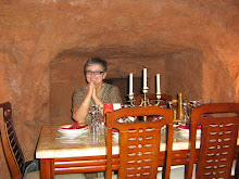
The photo was taken just off the main square in Qrendi where we planned to meet at 9.45.  The full walk was planned as a 7 hour circuit leaving from Luqa but I could not work out how to get to Luqa for 8.00am without adding a further two hour walk from M'xlokk so I decided to get buses to Qrendi and join part way along the route.  Other people had also decided to take this option.  Qrendi is already familiar to me, but this time we were not intending to walk out to Hagar Qim although we did start off heading towards Mqabba which was the direction we started out for our previous circular walk from Qrendi.

The focus of this walk was to visit four of the seven Santa Marja churches on the old processional route from Mosta.  The difficulty was that we set off at a cracking pace in order to cover the distance and everyone else on the walk was Maltese so the leader used Malti to explain what was happening.  As a result, everything is somewhat blurred and I'm not sure what churches we visited.  

I do know that we visited a lovely medieval chapel at Mqabba that was dedicated to St Basil and had all the features of the medieval chapels that I've visited elsewhere - square construction, vaulted arches, single bell tower over the door.  It has probably had several additions since it was first built and it appears to have been renovated recently.  There is an interesting skull and cross bones in the courtyard with the date 1776 and a date on the side of the church is 1669.  

We visited here just after leaving the main square of Mqabba which I think is where one of the Santa Marjas is and where we stopped briefly for refreshment.  I called in to one of the band clubs around the square and ordered a black coffee because I was feeling a bit off from the Maltese winter cold that I have finally picked up.  When it came, I just had time for a couple of sips before I noticed we were all on the move again, so I had to leave my mug steaming on the table.

Somewhere on the route, I found we were walking past a familiar chapel and the country road was familiar.  I realised it was the place I got lost when I was on the medieval chapels tour with the department of Culture and the Arts (see previous post).  Another piece of the jigsaw fell into place, but I'm not sure now where it was - I'll have to look back through the blog!

We passed the edges of Kirkop which is where my father used to work when I was here as a child but I couldn't really remember where the workplace was.  Then we skirted the airport which has had such a dramatic impact on the landscape of the South.  When it was built, many ancient sites were lost forever and during WW2 the "airport villages" suffered very badly in the bombing that targeted the military stronghold.  Even walking around the air strip now is difficult and we had to scramble over an overgrown rubble wall and walk along the edge of the red fence that surrounds the air field.

Once round the Southern end of the air strip, we headed once again across the fields towards Gudja where we could see the triple steeples of Gudja Parish church dominating the landscape.  We paused once again in the square where I tried for another black coffee with a similar outcome to the Mqabba attempt!  By now I was starting to feel very tired but I had been offered a lift from Ghaxaq which was our next port of call so I was able to march on again across the fields.

It was exciting for me to discover as we came to the outskirts of Ghaxaq that the road came out at the cross roads where one road leads back down to Birzebbugia so I now know how to get from either M'xlokk or Birzebbugia via Ghaxaq to Gudja on country roads.  My mental map of Malta keeps extending!

Some of the more intrepid walkers now continued on up Wied Garnaw (see an earlier post) back to Luqa but I was glad to walk with a couple from Birzebbugia, whom I had met on the Malta Habitats course in Mosta, back to their car.  After doing some car shuffling so that they could pick up their other car in Qrendi, I was grateful to be dropped off in my home town.  Sylvia tells me that she has been reading my blog, so hello and many thanks!

M'Xlokk to Ghaxaq to Birzebbugia


I set off to see if I could find the live crib in an air raid shelter in Gudja but instead completed a circular walk from Marsaxlokk via Ghaxaq and Birzebbugia.  I already had most parts of this walk in my repertoire but this was the first time I linked them all together.

I set off at about 3.00 pm to walk through the valley from M'xlokk and then along the main road to Gudja to get to the crib site at 4.30 when they open.  The walk up through the valley feels like home ground now and I noticed the farmers were out spraying their crops using a back pack - not sure what they use.  Not for the first time, I wondered about the lines of holes a bit bigger than a tin can that edge the roof of some of the older farmhouses.  I learnt on Saturday that these are for pigeons to nest in so that the farmer's have a ready supply of pigeon pie.

When I got to the main road that leads to the roundabout outside Ghaxaq, I guessed the continuation of the country road lead off from the other side and a little further down.  When I had made the journey before, I had followed the main road and found it uncomfortable so I was very keen to find an alternative.  I headed left down a winding country lane that seemed to be going in the right direction.  After a while, I saw a farmer walking towards me carrying a bundle of crops under his arm.  I asked him if this was the way to Ghaxaq or Gudja but since I'm not used to pronouncing these two words, he looked at me with amusement.

"Do you speak English?" he said

I repeated the question, leaving off Gudja this time in case that was confusing.

"Oh, Ashah," he said with a wry smile and I realised my English brain was still insisting on a k sound at the end because of the q spelling.   "Keep going straight", this with the up and down gesture of one arm along the line of the road.

The road curved on through well maintained rubble walls, past the local firework factory and eventually came out at the main road to Gudja on the outskirts of Ghaxaq.  I turned left still debating whether I should keep going on the main road and hope to find the crib and then get two buses back to Marsaxlokk because it would be after dark when I got out.  

Noticing the start of the walk back to Birzebbugia made up my mind for me and I set off to return down through the other side of the valley.  Even so, I had to walk quickly to beat the setting sun and it was getting dark with all the lights coming on as I walked back along the coast road past Fort St Lucjan.  The photo of clouds was taken on a different walk but captures the feel of the walk back down through the valley.

Friday, January 2, 2009

St Peter's Pool


My first walk for 2009 was again up onto the Delimara headland from Marsaxlokk but this time I explored the cliffs at the Northern end looking out towards Sicily, only a 2 hour fast sail across the Mediterranean.  The trip across the water has been made for centuries.  As far back as the temple era, there is evidence of links between Malta and Sicily and the ancient animal bones found at Ghar Dalem on the other side of Marsaxlokk suggests there was even a land link at the dawn of time.

The photo heading up the post is of a weathered rock at the base of the globigerina limestone cliffs.  The weathering in this area is stunning and on some ledges I felt I was entering a sculpture gallery.  

After walking up the steep path to the Delimara ridge, I found a country road with lovely freestanding stone walls freshly maintained that had a makeshift sign saying simply 'Pool'.  There is someone living around here who pours love into the building of rubble walls!  They include everything not wanted in the fields, including an old gas stove, and still make them look like a work of art!

After following one of these walls that included garden beds built into the road with mature shrubs in them, the wall encloses a field chapel with a well next to some kind of fortification, a battery or redoubt probably build in the last century or two.  A little further on there is a walled up Italian style villa with an Alpen style wooden hut in the garden.  One of the practices I have noticed here is that when a house is left vacant for any length of time, the ground floor doors and windows are walled up with blocks.  

The road leading up to the villa has stunning views across a bay to a natural tunnel in the headland through to the next bay around.  I think from my map that this must be Ras il-Fenek.  The globigerina limestone cliffs have been tilted here and it looks like the sea is running downhill.  I think I can remember coming into this bay from the sea when I was a little girl.

Walking on around the cliff track, I came upon St Peter's pool from the Northern end.  This is a popular bathing area in the summer because the smooth weathered limestone ledges make good sunbathing spots  At this time of year the few people that were there were well rugged up and one person was sleeping in the last remaining pool of sunshine as the sun was heading down behind the cliffs and her two dogs were exploring the rock pools that patchwork the whole area. 

I took a track that crossed the steps leading down into St Peter's Pool from the carpark and walked around to the ledges below the Southern cliffs that I think are called Ponta tat-Tumbrell (Tumbrell Point).  I've made a mental note to find out why it has this name but it was at this point that I walked into the stunning sculpture garden.  Here the ledges leading out to the sea have been weathered into a mosaic of rockpools as well as cut into salt pans.  Massive boulders have fallen from the weathered cliffs and eroded into fantastic shapes.  Some have melted back into the base stone and smoothed into beautiful curving shapes, others have ridges of harder stone running through them and punctuating the smooth weathering of the softer stone.

I had to linger, and when I noticed that the sun was close to setting, I realised that I had run out of time to find the path round to Delimara bay so that will have to be another expedition.  I took the steps up to the carpark and found my way back to Delimara road, passing very cautiously by a barking farm dog that looked like it had an Egyptian temple dog ancestry.  Coming back to the path down to Marsaxlokk with the sun going down behind the power station, I got some great shots of the chimneys and the Freeport at Birzebbugia.

Today I want to walk up through the valley to Gudja and see if I can find the live crib that the council has put on.

Thursday, January 1, 2009

And first for 2009


My friends and relatives in Australia started a few hours before me, my friends and relatives in UK were nearly the same time and my friends and relatives in USA were a bit behind, but we're all into 2009 now so I hope everyone manages to find whatever they are looking for in this bright new year.

Here in Marsaxlokk, it's a bright, sunny start to the year but cold.  I will go out walking this afternoon to get warmed up.

My last walk for 2008 was to Delimara point, the headland that marks the northern border of Marsaxlokk harbour.  It's amazing that I've left it this long to discover it but I assumed that it was now dominated by the Enemalta chimney and fuel tanks located at the edge of the bay so whenever I walked up over the ridge towards Marsascala and St Thomas Bay, I by-passed the country road leading towards the point.  

Yesterday I decided to explore.  I'm glad I did!  Once I got past the Enemalta power plant which is not as dominant as it is on the Birzebbugia side because it is built down inside a quarry, I discovered a dramatic headland with another Maltese story etched on the landscape.  The photo that heads the post is of the light house that now stands towards the end of the peninsula and staffed by a surveillance branch of the army.

Delimara got its name from the lighthouse - Dejr l-Imnara in Malti means lantern house.  It was built in 1855 which is recent in Maltese history.  Before that, at the time when the soldiers of Suleyiman the Magnificent sailed into Marsaxlokk harbour in 1565 there was nothing to mark this peninsula that stands between the Straits of Sicily and the largest harbour in Malta (yes, Marsaxlokk is bigger than Grand Harbour).  

The knights built some fortifications at the end of the peninsula in 1770s  (earlier batteries and forts, including fort St Lucjan were built prior to this in the 17th century) but no lighthouse was put up for fear of making it easier for further invasion.  The British then built fort Delimara nearby in 1880 and this now straddles the end of the peninsula with a ditch all around and sloping fortified walls.  At the seaward end, the globigerina limestone from which it is made has been weathered dramatically.

At that point, I had a phone call from my friend Celia to wish me a happy New Year and we chatted for so long that when I continued the post and pressed to publish I found that I was no longer on line so lost the end of yesterdays walk.  So this is a re-run!

What struck me most about Delimara point were the sea and landscapes that have been etched by the culture of Malta over the centuries.  At the end of the peninsula there are salt pans rippling silver in the afternoon sunlight, waves surge around the rocks at the foot of the cliff and the circles of the fish farms mark the undulating sea further out.  On the land there are the familiar terraced fields with rubble walls and the hunting hides with stone bird tables.  What was new to me in a couple of places near to hides were what looked like cricket wickets surrounded by bird tables.  It took me a while to work out that they were cleared ground where the bird trappers would put up their nets ready to pull the string and drop them on the birds that came down in response to the calls of the caged birds on the tables.  Now that bird trapping has been banned in this brave New Year, I imagine that these cleared areas will gradually be reclaimed into the landscape.

There is also a lovely rocky bay on the seaward side of the peninsula and it looks like there are walking tracks that go around the cliff there so I determined to make that my first walk for 2009.  I've just got back from that walk and will write about that in my next post.


Wednesday, December 31, 2008

Last post for 2008


It's New Year's Eve here in Malta and I thought I should mark the end of 2008 with a brief post.  The photo that ends the year is of a rainwater pool in the garigue on the walk from Birzebbugia to Ghaxaq.

This year I stopped putting all my energy into paid work as I had been doing for over forty years of my life.  It took me a remarkably short time to find new structures to give shape to the expression of my energy.  I realise now that this blog, set up in May/June as I began my year of travel, has been one of those structures and I am so glad that my niece, Sholeh, had the foresight to encourage me to do it.

It has taken me longer to start working out what my priorities might be in this new, self-directed phase of my life.  It looks as though I am settling into the life of a grey nomad at least for a few years.  Packing up all my household goods and planning what I had intended as a 'gap' year of travel to mark my retirement from paid work has been a great opportunity to start thinking about what I actually need in life.  With my possessions mostly packed away, I now have the chance when I return to Australia at the end of May to sort through all that 'stuff' and pass on the things I no longer need.  

The sorting out of tangible possessions is somehow connected to the transfer of the investment of my energy over my life.  My household was established with the funds from my paid work and supported my input of energy in that direction.  Now I can draw down on that resource and get rid of the things I no longer need.  What I still have to work out is what I do with any accumulated resources once I no longer need them to support my own life.  I want to know that in a small way, my life's energy will contribute to the continuation of a more just and sustainable world.

A priority for me now is maintaining connection with family and friends.  This blog helps with that, but I also need face-to-face contact and my friends and family are scattered throughout the world.  This means that I have to keep travelling in order to maintain established relationships but travelling makes it more difficult for me to build new social connections.  This is one of the factors that leads me more and more strongly towards making Malta my base where I can build a sense of community as well as being in a more central space from which to visit and be visited by.

So 2008 has helped me to start thinking about all that and 2009 will see me moving further towards putting it all into practice!  I wish all my friends and family a good, peaceful year and look forward to talking some more with you.

Sunday, December 28, 2008

Walking to Hagar Qim


Yesterday I joined another Ramblers Malta walk from Siggiewi (Sigg rhymes with 'sidge' and iewi rhymes with kiwi) to the temples at Hagar Qim and Mnadjra.  It was another beautiful afternoon for walking but the morning was not promising with a thunderstorm accompanying my breakfast.
  
The meeting time in Siggiewi was 2.00pm and I gave myself plenty of time for the change of buses in Valletta.  As we were pulling out of Valletta through Floriana, I noticed piles of what looked like snow in the corners of gutters and thought idly that some people must have gone to great lengths with their cribs.  This morning in the local papers there are reports and pictures of people walking in knee high hailstones in Valletta!

I arrived early in Siggiewi and had coffee in the local 'Knights' bar near the church square where I was the only woman.  When my eyes had got accustomed to the gloom I noticed the toilet sign for men only but was reassured by the barman that it was 'opposite' too.   Then after a stroll around the town, I sat in the sun on the steps of the parish church of St Nicholas and ate my lunchtime sandwich as I read up on the local villages in this area.  Like Ghaxaq (previous post) Siggiewi has two band clubs around the square and several chapels.  

There was a big turn-up for the walk which was led by Dr Gunter again.  We set off through the rural landscape around Mqabba to Xrendi (don't pronounce the X).  Mqabba is famous for its Globigerina limestone quarries.  This is the softer of the two types of limestone found in Malta.  Coralline limestone is the harder variety that is more difficult to work with.  I realised from my reading that I have been getting the two labels mixed up in previous posts so read anything before this one with caution!  

The photo that heads this post is of a farmer working his field that has been established in an old quarry.  There are good examples of this recycling practice around this area and the quarry sides give protection from the wind and help to retain moisture.  The fields in general are well maintained and look very fertile but we learnt that the new way of growing grapes along wire is actually wasteful of water.  The old Maltese way was to allow the plant to straggle along the ground and this helped to keep the soil moist. 

As we passed one of the square farmhouses that dot the Maltese landscape, the familiar dog appeared on the roof, but this one was different from the usual hunting dogs.  It had the pointed ears and long legs of the Eqyptian temple dogs.  I have a small statuette of such a dog that was sold to me in Luxor by Moustache Ali (see my post several months back!).  Dr Gunter suggested the dog was an indicator of the North African influences on the Maltese landscape.  I am again struck by the way in which Malta seems to be bringing together all the threads of my life!

After passing through Xrendi, we walked on to Hagar Qim and Mnadjra temples.  I had visited here with my mother some 15 years ago and was stunned then by the dramatic positioning alone on the cliffs of Dingli with the tiny rugged island of Filfla in the sea below.  That time we were the only people there although there was an ancient attendant sitting in a makeshift hut who sold us a ticket to go in.  

The temples are made of the softer globigerina limestone that has been quarried nearby since they were constructed around 3000BC.  Their position exposes the huge slabs to weathering from wind and saltwater.  I was prepared, therefore, for the protective shield that was going up around both temples and had read about the decision to gain EU funding to erect the cover.  What I was not prepared for was the huge and very ugly reception building that is being erected adjacent to Hagar Qim that jumps out of the landscape as soon as you walk down the road and drags your eye away from anything else.  Many people in Malta have been disappointed by the decision to build this monstrosity rather than the smaller one story building that was originally proposed.  I am very glad that I have images in my head of the temples before they were vandalised in 2001 and now again legally vandalised in the name of conservation.

We completed our circular walk back to Siggiewi as the sun was setting and colouring the clouds that were once again gathering.   We walked down an old WW2 airstrip now used as a road and the clouds above us were etched in purples, deep blues, pinks and even turquoise.  Back in the square, the bus to Valletta was about to leave and we drove back through village streets bright with Christmas lights.


Friday, December 26, 2008

Walking to Ghaxaq


Today is Boxing Day and I needed the 4 hour walk via Birzebbugia to Ghaxaq (pronounced Ah-Shah).  On Christmas Eve, I joined my landlord's family for a delicious seafood dinner - four courses of ftira, fish soup, shell fish and crab thermidor.  Then on Christmas day I went to Sue and David's flat along the Marsaxlokk front for a huge traditional British Christmas lunch that lingered into tea time!  So a long walk was exactly right for today.

The photo that heads up the post is of a stone bridge on the valley road between Birzebbugia and Ghaxaq.  The walk is lovely and well-described in the booklet on countryside walks that I picked up from the local council offices.  I have passed through Ghaxaq before when I was walking to Luqa to join a Rambler's walk but had never walked up from Birzebbugia.  I have learned from a library book called 'Towns and Villages in Malta and Gozo.  Part 2, The South' by Charles Fiott that the name Ghaxaq derives from the family name but must be linked to the word 'ghaxqa' which means a delight.  This in turn probably influenced the village's motto laeta sustinio (I shall stay happy).

I also learnt from the library book that Ghaxaq, like many of the Southern villages and unlike the North, has two factions.  Each faction has its own band club, festa and firework group and there is strong rivalry between the two.  Sometimes, but not always, the division is also on political grounds.  The parish church is the centre of all the competing activity leading up to festa time but the band clubs and smaller churches are the practice areas.  Even on Boxing Day, there was a lot of activity going on around the band clubs with children singing carols and Christmas lights on the tree inside.

In addition to the band clubs, churches and winding streets with interesting glimpses of farmhouse courtyards, Ghaxaq has a House of Shells with a facade covered in patterns made from shells, as well as a watchtower for Marsamxett harbour and known as it-Turretta (the turret).

On the return journey, I tried to follow the directions in the walking guide.  This should have brought me past an abandoned Roman villa and some ancient cart ruts but somehow I missed the turn and after wandering up and down a road that seemed to be used as a tip, I returned the same way I had set out.